Forecast through Thanksgiving/Black Friday:
We are stuck in a dry pattern through the end of the week with mostly sunny days. Highs near 50 degrees near the base and 40s for the upper mountain, as high pressure is sitting over the West all week.
We are seeing the inversions we feared for this week, with the temperatures this morning in the 20s at the base and mid-30s at 8000 ft. That will make it more difficult to make snow this week.
Weekend Cold Shift:
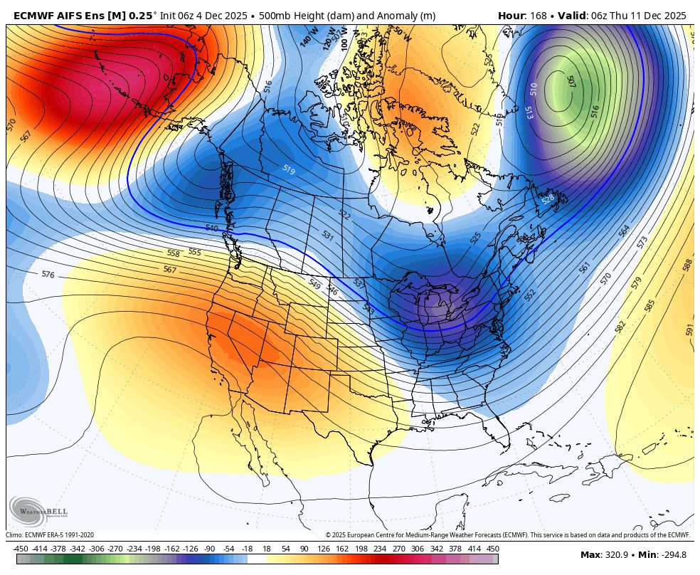
The long-range models did pretty well in forecasting a shift in the pattern for the weekend, and they are still showing the ridge amplifying up the West Coast, with a cold trough digging into the West by Saturday into Sunday.
At the very least, that is going to send high temperatures tumbling for the weekend into next week, with highs only in the 30s for the lower elevations and 20s for the highest elevations. Even better will be overnight lows in the 20s or even colder, and we should see a positive shift in snowmaking conditions.
The question for the weekend is whether we will see any snow showers as the cold front moves through from the north. The majority of the forecast model runs this morning show either a dry weekend or very light amounts of precipitation.
We’ll continue to watch the trends all week, but right now we are still expecting only a few snow showers and a dusting of snow, if anything, for the weekend. The bigger news will be colder air and much better snowmaking conditions.
Long-Range Forecast:
The dry but colder pattern is expected to continue into next week, which is the 1st week of December. In my last post, Saturday morning, two weeks out was the 4th of December, and it looked dry through the 4th with no signs of any significant storms. That is still the case, with well below average precipitation expected for the next 10 days.
That doesn’t mean we won’t see any precipitation. Some models show chances for snow showers as weak systems drop down from the north, similar to the weekend, but as of right now, nothing looks to bring more than a dusting of snow. The good news will be continued cold and snowmaking.
Signs of Hope:
There is some hope for more natural snow in the longer range, and it may not just be fleeting hope. We have some backup to the idea of the ridge in the eastern Pacific retrograding away from the coast, and troughing over the West Coast, starting around the 5th/6th of December.
First off, we have a pretty good agreement this morning among the ensemble mean models in a similar shift in the pattern. Also, the teleconnection pattern forecasts for the Pacific North American (PNA) pattern seem to be lining up in a -PNA (West Coast trough) pattern emerging around the 1st weekend in December.
Looking at the jet stream forecast across the northern Pacific Ocean, there is also decent agreement in a retraction of the jet stream (East Asian Jet) by the 6th, which would support the ridge retrogression up towards the Aleutians.
The MJO (Madden Julian Oscillation) looks to be in a more favorable phase for this shift more towards mid-December on its current trajectory. I don’t know if that will mean this shift is showing up a bit early or the MJO will just join in and help to lock in the -PNA pattern later in December? That’s what some of the long-range models are suggesting.
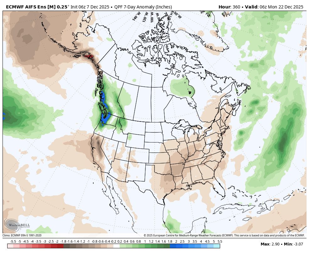
The 5-day precipitation anomaly forecasts are finally starting to show near to above-average precipitation and a wetter pattern for CA between the 5th – 9th of December.
This is still beyond day 10, so always take it with a grain of salt, but the signs are looking better, as of today, for the 2nd week of December.
BA